Lands at Haynestown
Dundalk
53.973212, -6.416354
Available on request
- Space Available19.54 ac / 7.907 ha
- Summary
- Location
- Brochures
- Agents
- Enquire
Summary
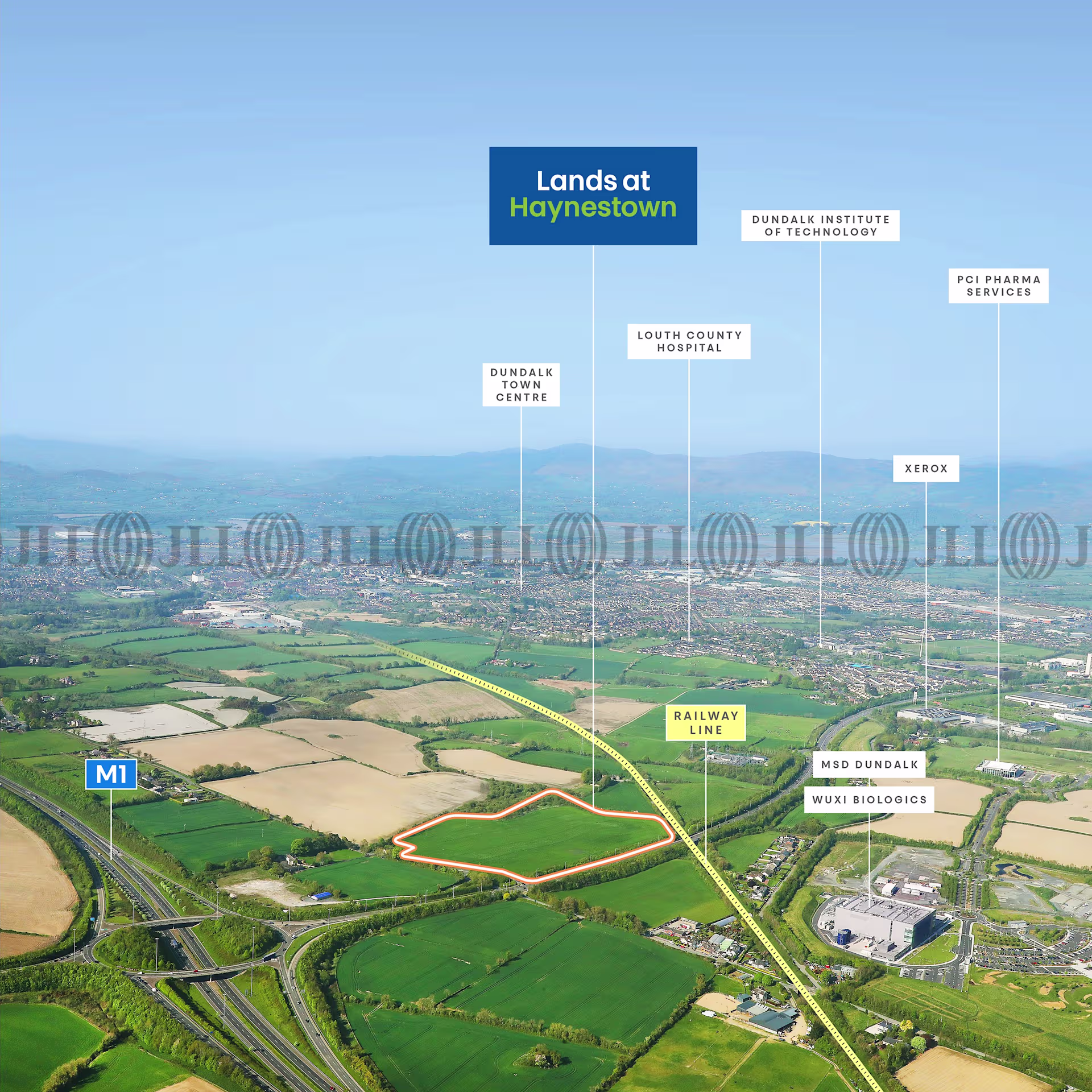
Lands at Haynestown, Dundalk, Co. Louth
- Development Lands extending to 19.54 acres (7.91 hectares)
- Site currently in agricultural use
- Zoned E2 / Business and Technology
- Excellent strategic location equidistant between Dublin City and Belfast City
- Situated close to numerous transport links including junction 16 of the M1 motorway (150 meters)
- Potential to develop a 425,000 sq. ft (39,540 sq. m) Business & Technology hub
- Proposed new railway station on Dublin-Belfast line adjoining the site
Description
The property comprises greenfield development lands, irregular in shape and predominantly in agricultural use, extending to a total area of 19.54 acres (7.91 ha). The lands generally have a level topography throughout. The lands are bound by agricultural and woodlands to the north, the L7165 (local road) to the west, the N52 road to the south and the Dublin-Belfast railway line / agricultural lands to the east. In addition to the Louth County Development Plan 2021 – 2027, the property is also included in the Mullagharlin Framework Plan which designates the lands as a future hub for sustainable, high-quality employment. The plan outlines potential for up to 425,000 sq. ft. (39,540 sq. m.) of commercial space with buildings ranging in height from 3 – 5 storeys. Notably, the framework also envisions a proposed new railway station on the Dublin-Belfast railway line along the eastern boundary of the site.
Location
Agent

Ollie Lyons
Director - Development Land
Agent details